- Pagina inicial /
- Livros /
- Engineering & Transportation /
- Engineering /
- Computer Modelling /
- Remote Sensing & GIS /
- Learning Geospatial Analysis with Python: Unl...
0 ratings


Artigo n.º:
92488558
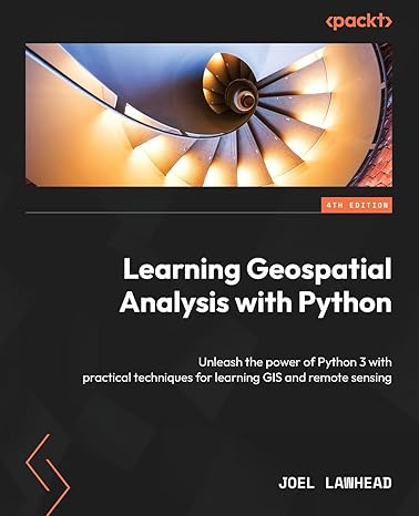
Learning Geospatial Analysis with Python: Unleash the power of Python 3 with practical techniques for learning GIS and remote sensing
85% of respondents would recommend this to a friend
Artigo n.º:
92488558
STD 1344695
Detalhes do Preço
Excluindo custos de envio e alfandegários ( Os custos de envio e alfandegários serão calculados na finalização da compra )
*Todos os artigos serão importados de EUA
0 ratings
Escrever uma avaliação
Em stock
 Importado da loja USA
Qtd.:
Encomende já e receba por volta de Sexta-Feira, Outubro 09
Transação segura
A Ubuy trabalha arduamente para proteger a sua segurança e privacidade. O nosso sistema avançado de segurança de pagamentos garante a confidencialidade ao encriptar as suas informações durante a transmissão, utilizando os protocolos AES (Normas de Encriptação Avançada) e SSL (Camada de Sockets Seguros). Os seus dados de pagamento estão 100% seguros, pois não partilhamos os seus dados de pagamento com vendedores terceiros.
Os nossos principais Parceiros Logísticos


Unleash the power of Python 3 with practical techniques for learning GIS and remote sensing.

Fast
Shipping

Devolução
gratuita*

Embalagem Segura

Produtos 100% Originais

Certificação PCI DSS

Certificação ISO 27001



Note: Step Down Voltage Transformer required for using electronics products of EUA store (110-120). Recommended power converters COMPRAR AGORA.


O que se Destaca
Practical Techniques
Offers hands-on methods for mastering GIS and remote sensing, ensuring learners can apply concepts in real-world scenarios effectively.
Updated Content
The 4th edition provides the latest advancements in geospatial analysis, ensuring relevance and up-to-date information for modern applications.
Python 3 Focus
Centrally features Python 3, equipping users with essential programming skills tailored for geospatial tasks and empowering them for future projects.
Detalhes do produto
| Publisher | Packt Publishing |
| Publication date | November 24, 2023 |
| Edition | 4th |
| Language | English |
| Print length | 432 pages |
| ISBN-10 | 1837639175 |
| ISBN-13 | 978-1837639175 |
| Item Weight | 1.63 pounds (740 grams) |
| Dimensions | 7.5 x 0.98 x 9.25 inches (19.1 x 2.5 x 23.5 cm) |
Quem Deverá Comprar?

-
GIS Students
Ideal for university students studying Geographic Information Systems, seeking hands-on Python experience for data analysis projects.
-
Data Analysts
Data professionals looking to enhance their skills in geospatial analysis and leverage Python for location-based data insights.
-
Remote Sensing Enthusiasts
Individuals interested in remote sensing applications can benefit from practical Python techniques highlighted in this edition.

-
Beginners to Programming
Those without programming experience may find the content challenging without foundational knowledge in Python.
DESCRIÇÃO DO PRODUTO
Learning Geospatial Analysis with Python: Unleash the power of Python 3 with practical techniques for learning GIS and remote sensing
Tem alguma Dúvida? Converse connosco
Perguntas e respostas do cliente
-
Pergunta:
What are the key features of Learning Geospatial Analysis with Python - Fourth Edition?
Resposta: This edition focuses on enhancing your GIS and remote sensing skills using Python 3. Key features include practical techniques for data manipulation, visualization, and analysis of geospatial data. The book covers libraries such as Pandas, GeoPandas, and Matplotlib, providing hands-on examples and projects. These features empower students and professionals in fields like urban planning and environmental science to efficiently analyze spatial data, improving decision-making processes and facilitating data-driven insights. -
Pergunta:
Is this book suitable for beginners in geospatial analysis?
Resposta: Yes, Learning Geospatial Analysis with Python is suitable for beginners. The book starts with foundational concepts before progressing to more advanced techniques, ensuring a gradual learning curve. Additionally, it includes clear explanations and practical examples, which helps newcomers grasp complex ideas effectively. Many readers have successfully transitioned from novice users to competent practitioners, applying the learned skills in various fields such as geography, environmental studies, and even software development. -
Pergunta:
What programming knowledge is required to benefit from this book?
Resposta: While prior knowledge of Python is beneficial, it is not mandatory. The book assumes a basic understanding of programming concepts and provides explanations of Python syntax as needed. This helps readers who may not have extensive experience with Python to grasp geospatial analysis effectively. For practical application, users can expect scenarios that involve real-world data sets, making the learning experience relatable and applicable across various professions including data science and geography. -
Pergunta:
Can I use this book for self-study?
Resposta: Absolutely, this book is an excellent resource for self-study. It is structured in a way that allows learners to follow along at their own pace, with each chapter building on the last. The hands-on projects encourage practical application of concepts, making them suitable for individuals looking to enhance their geospatial analysis skills. Self-learners in fields such as urban planning or environmental science can leverage the techniques learned to elevate their analytical capabilities. -
Pergunta:
Does this edition include updates or new technologies in geospatial analysis?
Resposta: Yes, the Fourth Edition includes updated content covering the latest tools and techniques in geospatial analysis, reflecting advancements in Python 3 and related libraries. Readers will find new chapters that delve into modern practices like machine learning integration within geospatial frameworks. This ensures that users are equipped with relevant and cutting-edge skills applicable in industries such as data analysis, remote sensing, and geographic information systems. -
Pergunta:
Are there practical examples or case studies included in the book?
Resposta: Yes, the book incorporates numerous practical examples and case studies throughout its chapters. These scenarios are designed to demonstrate how geospatial analysis techniques are applied in real-world contexts. Readers can expect case studies that cover various applications, from urban development to disaster management, providing valuable insights into the practical significance of the skills being taught and enhancing the learning experience. -
Pergunta:
How does this book address remote sensing in geospatial analysis?
Resposta: The book thoroughly addresses remote sensing, providing foundational concepts alongside advanced techniques for analyzing remote sensing data. It demonstrates how to use Python tools for processing satellite imagery, performing classification tasks, and extracting meaningful insights from geospatial layers. This is particularly useful for researchers and professionals in fields like environmental monitoring and resource management, as it offers crucial techniques for managing and interpreting complex datasets. -
Pergunta:
Can I find guidance on data visualization within this book?
Resposta: Yes, Learning Geospatial Analysis with Python includes comprehensive guidance on data visualization. Readers will learn how to create compelling maps and visual representations of spatial data using libraries like Matplotlib and Folium. This is crucial for professionals who need to present their analysis in visually intuitive formats, helping stakeholders understand complex spatial relationships and patterns in sectors such as urban planning, environmental management, and geographic research. -
Pergunta:
What makes this book stand out from other geospatial analysis books?
Resposta: This book stands out due to its practical approach and integration with contemporary Python libraries. Unlike many traditional textbooks, it focuses on hands-on learning, emphasizing real-world applications and case studies that make complex topics accessible. Moreover, it remains updated with the latest advancements in geospatial analysis, making it relevant and useful for both newcomers and experienced users alike, enhancing their skill set in various evolving industries. -
Pergunta:
Where can I buy Learning Geospatial Analysis with Python - Fourth Edition?
Resposta: You can purchase Learning Geospatial Analysis with Python - Fourth Edition from Ubuy. Ubuy is a reliable e-commerce platform that offers a wide selection of books and resources. By choosing Ubuy, you can ensure a straightforward buying process and access specialized products efficiently, making it a prime destination for acquiring this essential resource in geospatial analysis.
Remote Sensing & GIS Editorial Review
Learning Geospatial Analysis with Python: Unleash the power of Python 3 with practical techniques for learning GIS and remote sensing introduces readers to the diverse world of geospatial data processing. The well-structured chapters guide users through essential concepts like geospatial algorithms and remote sensing techniques, making complex topics accessible. Readers appreciated the thoroughness in each section, particularly in practical applications that help solidify understanding. Despite the book being comprehensive, it leaves room for improvement by not fully leveraging advanced libraries that could enhance workflows. Overall, this book serves as a valuable resource, providing a solid foundation for anyone looking to delve into geospatial analysis using Python.
Avaliações e Classificações dos Clientes
1 classificações de clientes
-
5 Estrela
100%
-
4 Estrela
0%
-
3 Estrela
0%
-
2 Estrela
0%
-
1 Estrela
0%
Avaliar este produto
Partilhe as suas ideias com outros clientes
Prós
- Well-structured and easy to follow chapters
- Great for beginners in geospatial processing
- Thorough coverage of GIS concepts and algorithms
- Includes practical applications and example code
- Focuses on open-source tools for accessibility
Contras
- Could include more advanced libraries and tools
CONFIANÇA NA PLATAFORMA E SEGURANÇA DO COMPRADOR

JK
Jasmin
Comprador verificado
“Great products and very good service: very easy and very fast international delivery.”
9 September 2026 · via Trustpilot
AG
Anke
Comprador verificado
“Wonderful online shopping experience, smooth transaction from the start. Payment method works conveniently and delivery is unexpectedly fast and reliable. You go the extra mile for service. What makes this even more amazing, you deliver to Namibia. I will remain a happy Ubuy customer and will increase my purchases for sure! Thank you!”
10 September 2026 · via Trustpilot
H
Hazel
Comprador verificado
“Very easy to find the products what you need, and so fast delivery, that’s why I highly recommended to others costumers to used ubuy.”
10 September 2026 · via Trustpilot
O
Opaleye
Comprador verificado
“I received exactly what I ordered I was skeptical about your site because that was my first time to order. But the order came timely and neatly packaged. I was not disappointed. Thank you.”
11 September 2026 · via Trustpilot
AC
Adele
Comprador verificado
“Easy to find and order what you want on the website. Delivery is quick to the UK”
8 September 2026 · via Trustpilot
Checkout Seguro
Entrega Global
Devoluções Fáceis
Produtos Genuínos
Histórico de preços do produto
Informação importante
- Limitações: para produtos expedidos internacionalmente, tenha em atenção que qualquer garantia do fabricante pode não ser válida; opções de serviço do fabricante podem não estar disponíveis; manuais de produtos, instruções e avisos de segurança podem não estar nas línguas do país de destino; os produtos (e materiais que o acompanham) pode não ter sido concebido em conformidade com as normas, especificações e requisitos de rotulagem do país de destino; e os produtos podem não estar em conformidade com a voltagem e outras normas elétricas do país de destino (requerendo assim o uso de um adaptador ou conversor caso seja apropriado). O destinatário é responsável por garantir que o produto pode ser legalmente importado para o país de destino. Quando encomenda à Ubuy ou aos seus afiliados, o destinatário é o importador de registo e deve estar em conformidade com todas as leis e regulamentos do país de destino.
- Nem todos os produtos listados na Ubuy estão à venda, uma vez que a Ubuy é um motor de busca global. Os produtos estão sujeitos a leis de exportação/comércio.
STD 1344695
Encomende já e receba por volta de Sexta-Feira, Outubro 09
Este artigo não está restrito no meu país. (Clique no link acima se este artigo não estiver restrito no seu país, para que a nossa equipa o analise e permita.)
Qtd.:
Transação segura
Em conformidade com a norma PCI DSS e com certificação ISO 27001:2022, com pagamentos encriptados e proteção total do comprador em todas as encomendas.
Os nossos principais Parceiros Logísticos
Entrega internacional mais rápida
Recursos e benefícios
- Transform your geospatial analysis skills with Python 3.
- Discover key GIS tools and libraries like PostGIS and QGIS.
- Automate workflows and visualize complex data effectively.
- Build complete geospatial applications for customized outputs.
- Learn remote sensing and real-time data tracking techniques.
- Access valuable insights applicable in various domains.
Ubuy Assurance
Experience worry-free shopping with 100% original products, PCI DSS-compliant payment security, ISO 27001-certified data protection, the fastest cross-border delivery, free returns *, and secure packaging on every order.